Source to lake
From 1976 to 2005 the river at Cressy averaged 5,265 µS/cm, and carried more than 240 tonnes of salt a day out of the catchment.
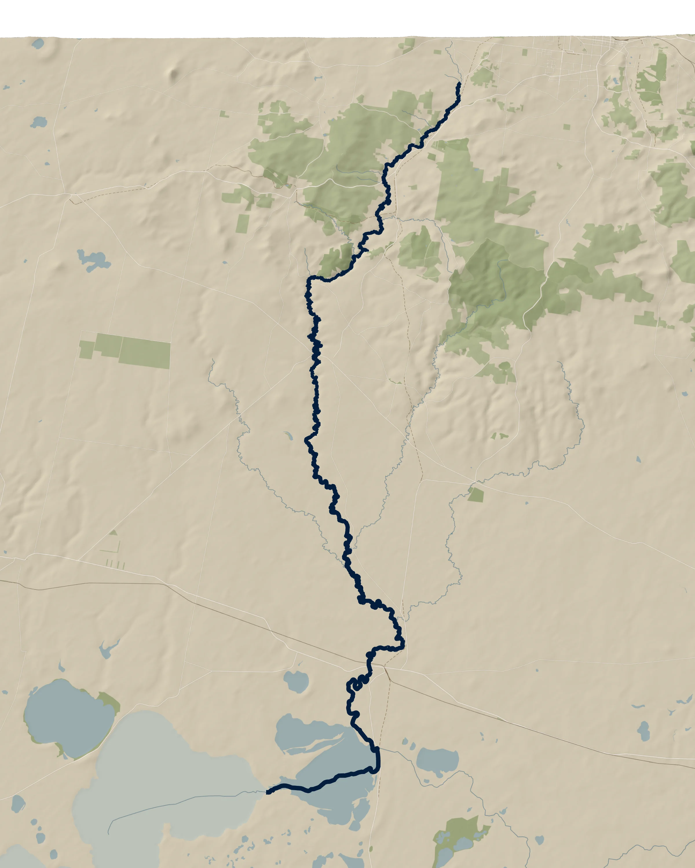 HaddonSmythesdaleScarsdaleNimons BridgeDevils KitchenCape ClearPitfield gaugeMount Misery CreekKuruc A Ruc CreekCressy gaugeThe diversionLake MartinLake Corangamite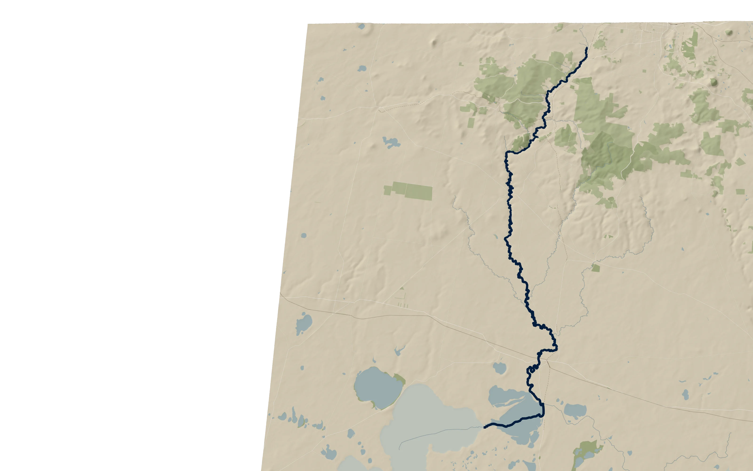
km 0.0about 382 m above the sea
Where the name begins
Smythes Creek comes down from the north and meets a stream from the west, 800 metres from Haddon. From here the maps call it the Woady Yaloak River.
Smythes Creek is the same water higher up, and in 1852 the two names were used for it. Wikipedia puts the source about 7 km further north, below Black Hill.
km 7.7about 361 m above the sea
Smythesdale
The river runs along the west side of the town, with a gravel walk beside it through Parks Victoria’s Smythesdale Streamside Reserve.
Friends of the Woady hold working bees on it every month. In 2025 they were given $7,000 to make habitat for rakali, the native water-rat, at Swamp Rat Flat, after a remnant population was found there.
- km 7.9
- Smythesdale–Snake Valley Road bridge
- km 9.5
- Lords Road bridge, beside the Equestrian Centre
km 13.1about 346 m above the sea
Scarsdale and the highway
Past Scarsdale the river goes under the old Glenelg Highway and then the new one, with a rest area named for it on the highway’s west side. Browns and Scarsdale was a borough of its own from 1862 to 1915.
- km 14.5
- Old Glenelg Highway bridge
- km 15.5
- Glenelg Highway (B160) bridge
- km 14.9, 16.1
- Hederic Shepherd Gully and Oldham Gully join
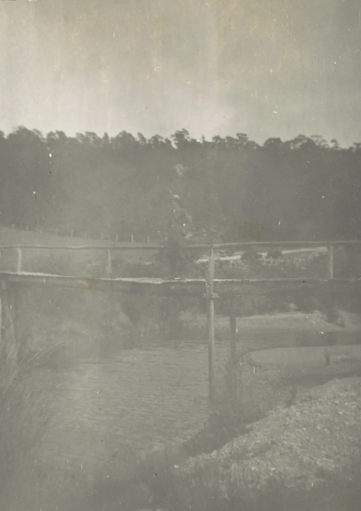
“Frank. Woady Yalloak Creek near Black Hill, 16th Dec 1905”, as the family album captions it, on a page headed “All Scarsdale & Newtown”. J. G. Roberts family album, State Library Victoria, MS 16188 km 20.8about 310 m above the sea
Nimons Bridge
A timber trestle of 17 spans, built in 1890 for the railway from Ballarat to Linton. Its deck is 103.6 metres long and stands 19.2 metres above the river. It was rebuilt with steel joists after a fire in 1953, and it now carries the rail trail.
The National Trust says the line closed in 1985; Victorian Places says 1983.
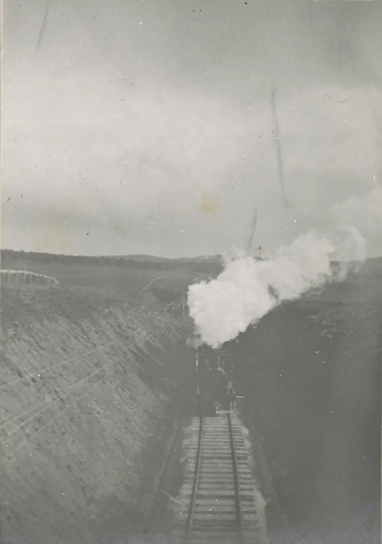
“Railway between Newtown & Woady Yalloak Creek”, 10 September 1907: a train on the Linton line, which crossed the river on this trestle. J. G. Roberts family album, State Library Victoria, MS 16188 km 26.4about 270 m above the sea
The Devils Kitchen
The river winds through a gorge walled with basalt columns. A gravel track goes down into the reserve and fords it.
A party sent out by Geelong’s Gold Exploration Committee reported gold here on 7 August 1852, in what was then Paterson’s Crescent. In 1864 its superintendent, Herbert Swindells, was paid £100 as the official discoverer of the Woady Yaloak goldfields.
- km 21.4
- Italian Gully joins
- km 28.9
- Springdallah Creek joins, by Piggoreet
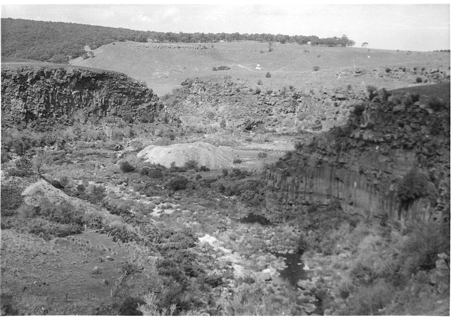
The basalt walls of the Devils Kitchen, 10 September 1961. John T. Collins, J.T. Collins Collection, La Trobe Picture Collection, State Library Victoria, H98.252/2421 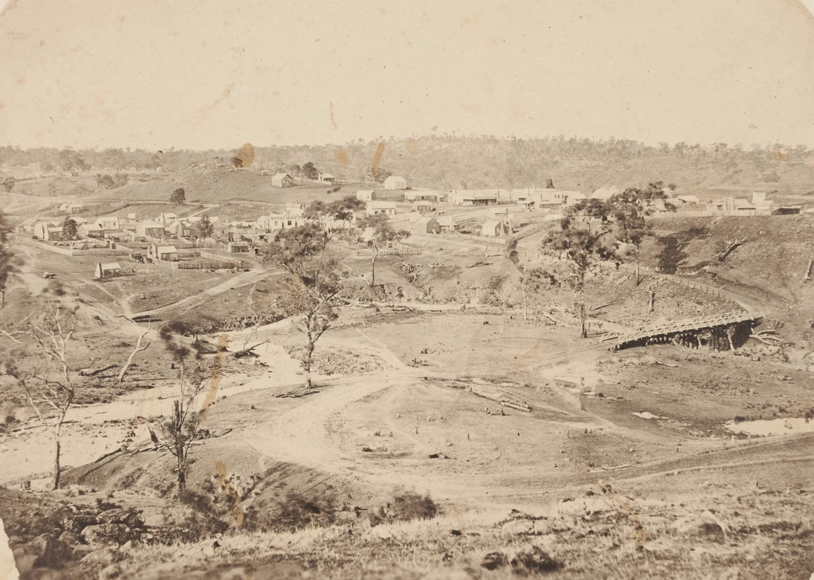
“The Devil’s Kitchen, Piggoreet, Smythe’s Creek”, about 1866: the river bed worked for gold, and the township above it. Unknown photographer, State Library Victoria, H1689 km 41.8about 231 m above the sea
Cape Clear
The Woady Yaloak diggings ran south from Smythesdale and Linton along the river, and Cape Clear was near their southern end.
- km 35.0
- Happy Valley Creek joins
km 49.7about 198 m above the sea
Pitfield, and the gauge
The state has measured the river here since 7 August 1917, at a gauge beside the Rokewood–Skipton Road bridge. It drains 309.6 km² of country above it.
The old bridge beside the new one is a wrought-iron Warren truss of two 26-metre spans, on bluestone abutments that may be from a timber bridge of about 1870. The road was once the Upper Portland Road.
George Augustus Robinson’s journal of 11 August 1841 gives the crossing here a Wadawurrung name, Currarerer.
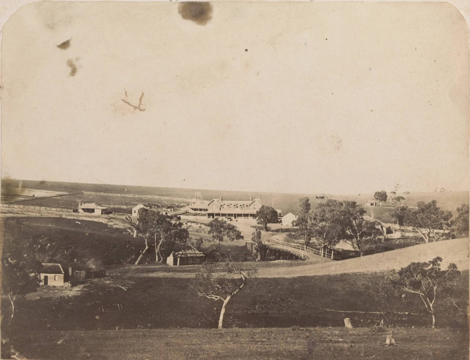
“Pitfield, Woady Yallock”, about 1859: the crossing before the iron bridge, with the road climbing to the hotel. Thomas Hannay, State Library Victoria, H2013.345/91 km 79.6about 149 m above the sea
The Little Woady
Mount Misery Creek joins from the east. The heritage register calls it the Little Woady Yalloack River where McMillans Bridge crosses it, 7 km away: an 1856 bridge given wrought-iron trusses made at the Vulcan Foundry in Geelong in 1888–9.
- km 81.8
- Naringhil Creek joins
- km 82.7
- Werneth
km 92.3about 132 m above the sea
Kuruc A Ruc Creek
The last big creek comes in from the north-east. Rokewood and Rokewood Junction stand on it, about ten kilometres from the river.
km 96.1about 133 m above the sea
Cressy
The second gauge, at Yarima, has measured the river since 8 May 1955, with 1,145.3 km² of catchment above it. Both gauges had their highest water on 14 January 2011.
Cressy began with Jean d’Auvergnay settling by the river, in 1840 by Victorian Places and 1837 by Wikipedia. A bridge was built over it in 1849.
- km 99.0
- Hamilton Highway (B140) bridge
- km 99.7
- Cressy
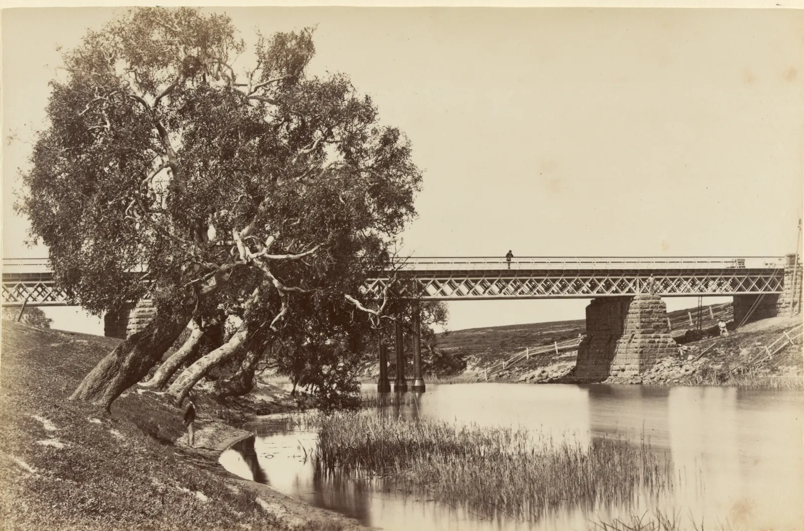
“Scene on Woady Yalloc Creek, Cressey, Western District”, about 1882: most likely the iron bridge the Australasian Sketcher drew as new in 1880. Fred Kruger, State Library Victoria, H39614/22 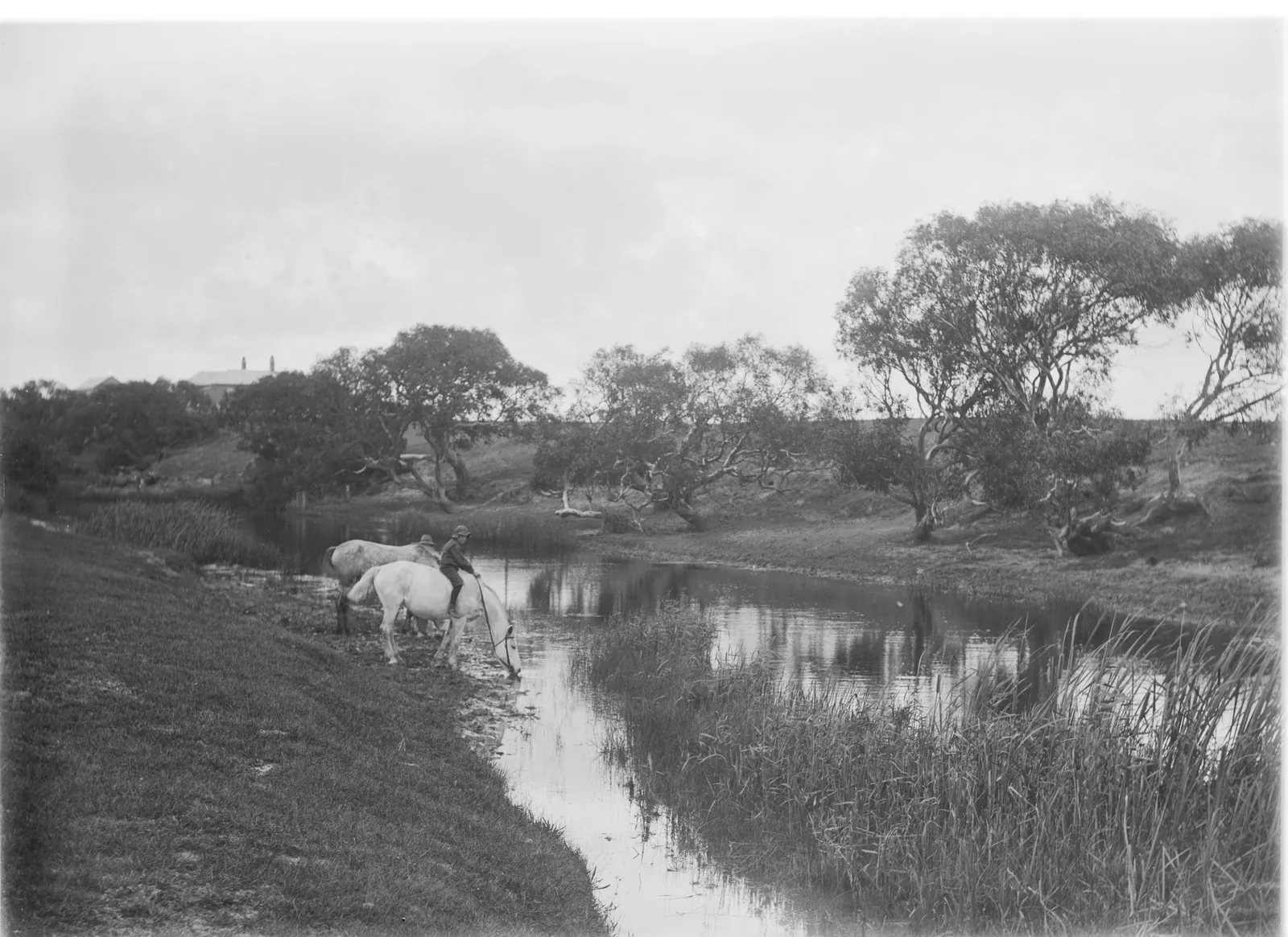
“Man watering horses at Woady Yallock”, about 1913. The record says only “Woady Yallock”; Knight’s negatives are of the Derinallum and Cressy district. Gabriel Knight, State Library Victoria, H87.52/97 km 110.0about 120 m above the sea
The diversion
After the floods of 1950 to 1953, a channel was cut to send the river east, away from Lake Corangamite, into Warrambine Creek and the Barwon above Inverleigh. It was commissioned in May 1959, to protect the farms round Lake Corangamite and Lake Gnarpurt.
km 111.7about 118 m above the sea
Lake Martin
The named river ends at Lake Martin, a shallow freshwater lake of 2,200 hectares. The Woady Yaloak is both what flows in and what flows out.
km 120.1about 116 m above the sea
Lake Corangamite
From Lake Martin the water goes on west, under the Cundare–Duverney Road, into Lake Corangamite: Australia’s largest permanent salt lake, about 230 km², and part of the Western District Lakes Ramsar site.
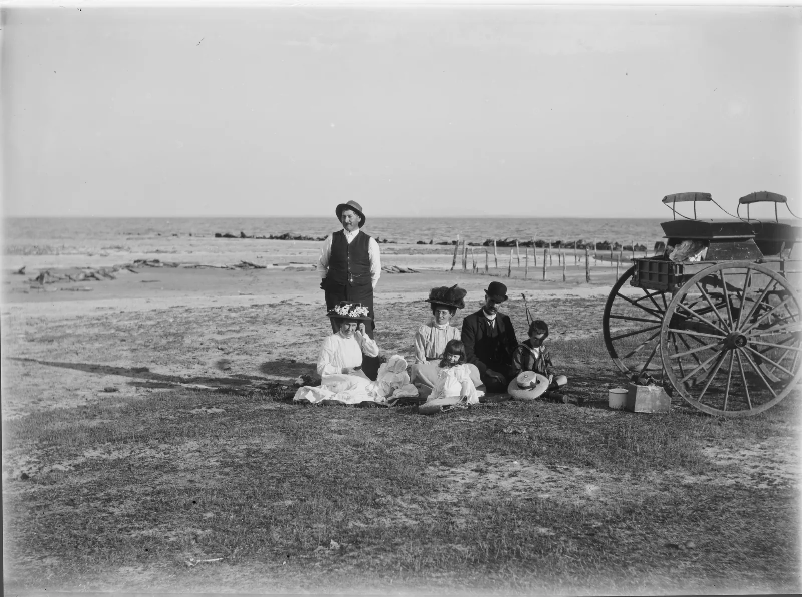
The Knight family at Lake Corangamite, between about 1909 and 1915. Which shore is not recorded. Gabriel Knight, State Library Victoria, H87.52/111
The names
Wurdi-yaluk
The state register of place names gives the river’s Wadawurrung name as Wurdi-yaluk, “big creek”, on the authority of the Victorian Aboriginal Corporation for Languages (Clark and Heydon, 2011). In the Wadawurrung Traditional Owners Aboriginal Corporation’s own glossary, yaluk is waterways.
| 1839 | Wardy Yalloak Chain of Pondsa pastoral run east of where Rokewood is now |
|---|---|
| 1841 | Currarererthe crossing at Pitfield, in Robinson’s journal |
| 1852 | Wardiyallockon letters from the Geelong prospecting party |
| 1855 | Wardy Yallockthe whole goldfield district, after the river |
| 1864 | Woady YaloakSwindells, “official discoverer of the Woady Yaloak goldfields” |
| Now | Woady Yallockthe Pitfield and Cressy bridges and Parks Victoria’s two reserves |
| Now | Woady Yaloakthe registered name, the school, the Society, the reserve |
Carries the name
Woady Yaloak Primary School
One state school on four campuses, formed in 1994 when the schools at Scarsdale, Smythesdale, Snake Valley and Ross Creek joined.
Office: 50 Becker Street, Smythesdale
Woady Yaloak Kindergarten
A kindergarten in Scarsdale, run by the Eureka Community Kindergarten Association.
25 Pitfield Road, Scarsdale
Woady Yaloak Historical Society
Keepers of the Smythesdale court house precinct since 1985, documenting the history of the Woady Yaloak district goldfields.
Research room at The Well, 19 Heales Street, Smythesdale. Wednesdays 9.30 am to 4.30 pm
Woady Yaloak Recreation Reserve
Smythesdale’s oval, with a stadium and stage, netball and tennis courts, and rooms for hire.
55 Heales Street, Smythesdale
Woady Yaloak Equestrian Centre
Arenas and a cross-country course, and home to four riding clubs, one on each of the first four Sundays of the month.
5 Lords Road, Smythesdale
Woady Netball Club
The Warriors. The football club folded in March 2026; the netball club carries on, at the Recreation Reserve.
Woady Yaloak Athletic Club
Athletics on Friday afternoons: track and field from October to March, under 5s to adults, and cross country from April to September on courses round Haddon, Ross Creek, Scarsdale and Smythesdale.
Haddon Recreation Reserve, Sago Hill Road, Haddon
Friends of the Woady
The Landcare group mending the river’s upper reaches at Smythesdale, at a working bee every month.
Woady Yaloak Parochial District
The Anglican district of Holy Trinity, Carngham, and St Paul’s, Linton.
Woady Yallock River streamside reserves
Two Parks Victoria reserves on its banks, at Smythesdale and at Pitfield, both reserved on 22 November 1983.
woadyyaloak.com.au, before this page
The Woady Yaloak Catchment Group
This address was theirs. In June 1992, two members from each of four Landcare groups (Werneth, Rokewood, Misery Moonlight and Pittong) met to look after the river’s whole catchment together. After 27 meetings they adopted a plan in March 1993: to halt the salt and silt coming down the river to Cressy.
Their first five-year targets were met in December 1996, a year early. Tree cover on the catchment’s private land went from 0.8% in 1990 to 2.4% in 2000. By 2009 they had 45 neighbourhood groups, and 190 landholders had done more than 1,400 projects worth $4.6 million between them.
In September 2004 they were given the national Landcare Catchment Award at Parliament House, and in 2009 Alice and Kevin Knight, sister and brother, both of them chairs of the group, were given the McKell Medal. In 2015 the local groups joined into one. The group’s registration was cancelled in July 2022, and its website went with it.
Their pages and annual reports are in the Web Archive: